Peel or Peal? What's in a name?
Peel Drive is one of the pedestrianised routes to the John Taylor Bellfoundry, and one might assume that it is so named because of this proximity to the bellfoundry. But, of course, if this were the case, then the road would be Peal Drive, not, as it is, Peel Drive. To establish the origin of this street name, we need to look at some of the other streets in the area … Let’s start with Cobden Street. A couple of quotes to begin with:
“Richard Cobden was a radical politician who was jointly responsible for creating the Anti-Corn Law League, which was about abolishing the laws that taxed imported wheat, making products like bread more expensive for people to buy. In Loughborough we have a school and a road named after Richard Cobden.” [1]
“Cobden Street at the end of which is Cobden Street School … [is] likely named for Richard Cobden, who was one of the founding members of the Anti-Corn Law League in 1838 and was the only person ever to beat [the Prime Minister of the time] in a debate in parliament, which led to the repeal of the Corn Laws in 1846.” [2]
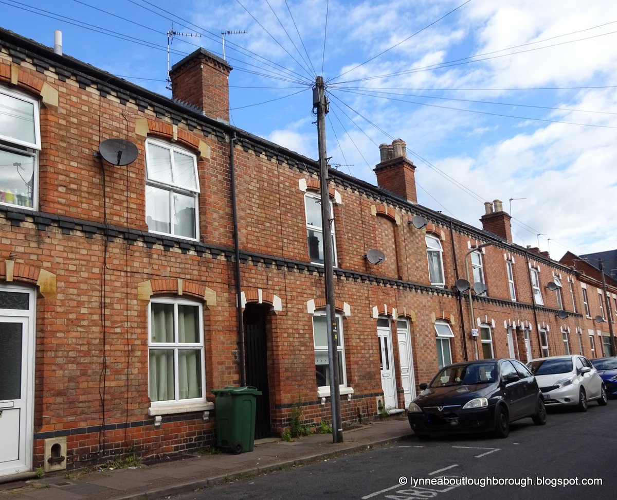
Originally, Cobden Street was quite a long street off Moor Lane at one end, and Freehold Street at the other. Today it runs between the buildings of the John Taylor Bellfoundry, into the Bellfoundry housing estate (probably built in the 1980s), and out through onto Moor Lane. The latter part comprises terraces of mostly red-brick houses, some of which have been rendered. There are a number of these properties that have been built using the Flemish bond brick pattern, and there is a small group of properties constructed from white brick, which bear a plaque naming them as ‘Orchard Terrace’. This would be a reference to the cherry orchard which used to grow in this area – and which also gave rise to the naming of a pub, called the ‘Cherry Tree’. There are no datestones visible here, but the properties are late Victorian, with the typical corner shops still obvious, but no longer used for that purpose.
 |
| Cobden Street at its Moor Lane end, 2024 |
 |
| Red brick with stone dressing and dark string course, Cobden Street, 2024 |
 |
| Housing on Cobden Street constructed with white brick, pictured in 2021 |
 |
| Cherry Tree Court, off Hume Street, references the former cherry orchard |
At the other end of the Bellfoundry housing estate, Hume Street runs off Sparrow Hill, at its corner with Cobden Street School, and it was here that the ‘Cherry Tree’ pub was situated. As well as the pub being demolished, there are no older houses left on this street, as it now leads down to and through the Bellfoundry housing estate. It is likely named for Joseph Hume, (1777-1855), who was a radical MP, as well as being a Surgeon and Fellow of the Royal College of Surgeons. [3]
 |
| There are no longer any houses along Hume Street |
 |
| One of the entrances to the Bellfoundry Housing Estate |
Chapman Street ran parallel with Hume Street, but was considerably longer. It linked Craddock Street with Cobden Street, running alongside the John Taylor Bellfoundry buildings. Originally, it would have been full of Victorian terraced houses, but today it is a short street leading into the Bellfoundry housing estate. The street is likely named for Edward Chapman (1839-1906), who was a Conservative MP, and one time Deputy Chairman of the Great Central Railway. [4]
 |
| Until recently, the former Labour Exchange was on Craddock Street and Chapman Street, now flats |
Running parallel with Cobden Street, Russell Street is also off Moor Lane, and leads to the Bellfoundry housing estate. Some of the terraced housing is constructed using Flemish brick bond, and the corner shops at the Moor Lane end are still in use as such. The name for this street is probably for John Russell, the 1st Earl Russell (1792-1878) who was a Liberal politician and two-time Prime Minister (1846-1852, and 1865-1866). [5]
 |
| Houses on Russell Street constructed in Flemish bond |
 |
| Looking down Russell Street from Moor Lane, 2024 |
Selbourne Street approaches the bellfoundry area from a different direction, so from Wharncliffe Road, although it has a junction in the middle of Russell Street. The houses on Selbourne Street are quite a mixture of small Victorian red-rick terraces, larger Victorian villas, some Edwardian properties and modern housing. The row of larger Victorian villas bear the following plaques: numbers 17 and 19 have a stone saying “J.B. 1885”, and were built by James Barker, of Barkers the builders; numbers 13 and 15 are “Selborne Cottages, 1892”, and numbers 5,7,9,and 11, form a group bearing a datestone recording “AD 1893”. Interestingly, the plaque on Selborne Cottages leads to the proposition that the road is named for Roundell Palmer, who was 1st Earl of Selborne (1812-1895), meaning the spelling on the road sign is perhaps incorrect. [6] Palmer was Lord High Chancellor of Great Britain for two periods, and was known for being a Peelite. [7]
 |
| Houses on Selbourne Street built "AD 1893" |
And so, we arrive at Peel Drive, which was once known as Peel Street, and was a short street running at right angles to Russell Street, and linked it to Cobden Street. Slightly re-routed, it now runs from Freehold Street, around the side of the Bellfoundry buildings, and then forms a pedestrian entrance to the Bellfoundry housing estate. Given what we know about the surrounding streets, which are mostly named after radical Victorian politicians, it should not be surprising to learn that Peel Street/Peel Drive was named for Sir Robert Peel (1788-1850), a Conservative politician who was twice Prime Minister, and also the founder of the police system we know today. [8] That the John Taylor Bellfoundry made its permanent home in this area in 1859, after having had a temporary foundry on Packe Horse Lane, is purely coincidental in the context of the surrounding street names.
 |
| Where Peel Drive and Chapman Street meet |
 |
| Another entrance to Peel Drive |
 |
| Peel Drive is off to the left before reaching the Bellfoundry works |
Streets: Chapman Street; Cobden Street; Hume Street; Peel Drive; Peel Street; Russell Street; Selbourne Street
Category: J Names of personal origin; K Commemorative and propitious names; L Thematic names
Map Co-ordinates: F6 - F7
NB Due to the temporary disappearance of my 2015 map, the map co-ordinates listed here are taken from the 'Loughborough & Shepshed street plan and guide', 12th edition, 2001, published by Service Publications Ltd..
____________________________________
If you are looking for a specific street, please consult the indexes:
Index A-B; Index C-F; Index G-L; Index M-R; Index S-Z
There is also an Index of Supplementary Streets (newer ones not on the chosen map) and an Index of all Blogposts
More information about the project can be found on About the Streets of Loughborough Project, and on Introduction to Street Names of Loughborough
____________________________________
NOTES
[1] Dyer, Lynne (2019). Secret Loughborough. Stroud: Amberley Publishing.
[2] Dyer, Lynne (2024). Finding more Loughborough connections in London. Available from: https://lynneaboutloughborough.blogspot.com/2024/03/finding-more-loughborough-connections.html [Accessed 31 March 2024]
[7] About Peelites
____________________________________
Posted by lynneaboutloughborough
With apologies for
typos which are all mine!
_______________________________________________
Thank you for reading this blog.
Copyright:
The copyright © of all content on this blog rests with me, however, you are welcome to quote passages from any of my posts, with appropriate credit. The correct citation for this looks as follows:
Dyer, Lynne (2024). Peel or Peal? What's in a name? Available from: https://lynneaboutthestreetsofloughborough.blogspot.com/2024/06/peel-or-peal-whats-in-name.html [Accessed DATE]
Take down
policy:
I post no pictures that are not my own, unless I have express permission so to do. All text is my own, and not copied from any other information sources, printed or electronic, unless identified and credited as such. If you find I have posted something in contravention of these statements, or if there are photographs of you which you would prefer not to be here, please contact me at the address listed on the About Me page, and I will remove these.
External Links:
By including links to external sources I am not endorsing the websites, the authors, nor the information contained therein, and will not check back to update out-of-date links. Using these links to access external information is entirely the responsibility of the reader of the blog.
Blog
archive and tags:
If you are viewing this blog in mobile format, you will not be able to easily access the blog archive, or the clickable links to various topics. These can be accessed if you scroll to the bottom of the page, and click 'View Web Version'. Alternatively, there is also a complete list of posts, which when clicked will take you to the page you are interested in.
Searching
the blog:
You can search the blog using the dedicated search box that appears near the top of the blog when viewed in the web version. Alternatively, you can search using your usual search engine (e.g. Bing, Google, DuckDuckGo etc.) by following this example:
site: https://lynneaboutthestreetsofloughborough.blogspot.com/ “Fearon Street”
NOTE – the words you’re actually looking for must be in “” and the first of these must be preceded by a space
Thank you for reading this blog.
Lynne

.JPG)
Comments
Post a Comment